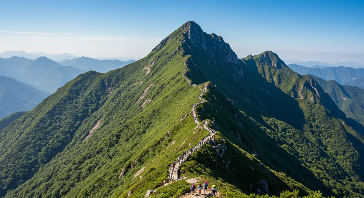
A Baiyun Mountain hike is a flexible nature break inside Guangzhou, not a remote backcountry trek. First-time visitors can ride the cable car from beside Yuntai Garden to Mountaintop Park, then continue toward Moxing Ridge on foot. Walkers can instead climb from the south entrance. The most important detail is that the cable car does not reach Moxing Ridge, the mountain's 382-meter high point.
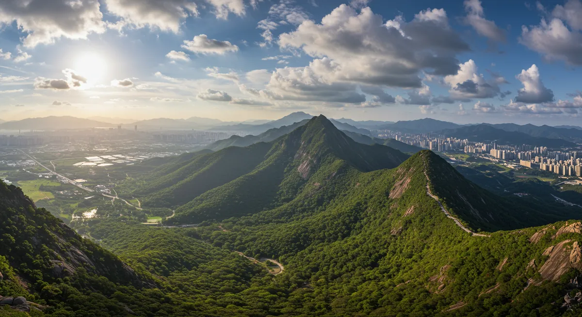
Key Takeaways
Turn this guide into a personal route with our free Guangzhou itinerary planner.
- Best route for most first visits: take the cable car uphill to Mountaintop Park, walk toward Moxing Ridge, and decide whether to walk or ride down.
- Official 2026 fare reference: the current Guangzhou pricing order sets full fares at ¥25 uphill and ¥20 downhill. Buying one ride each way totals ¥45.
- Summit reality: the cable car ends at Mountaintop Park. The scenic area's published transport guide marks the onward connection to Moxing Ridge as about 2 kilometers.
- Typical planning window: reserve 3–4 hours for a cable-car-assisted visit or most of a day for a longer climb and Moxing Ridge.
- Main challenge: paved roads and steps make navigation approachable, but sustained inclines, humidity, heat and wet surfaces can increase the effort.
- Check before departure: confirm the day's weather, cable-car operation and any attraction-specific access notices; the official fare order does not set operating hours.
Is Baiyun Mountain Worth Hiking?
Yes, Baiyun Mountain is worth adding when you want greenery, exercise and a broad Guangzhou viewpoint without leaving the city for a remote trail. It works especially well in a longer Guangzhou stay because the route can be shortened with the cable car or expanded into a substantial walk.
The Baiyun District government's profile, updated on November 26, 2025, says the scenic area covers 21.8 square kilometers and contains more than 30 hills. Moxing Ridge is its highest point at 382 meters above sea level. Those dimensions explain why trying to “see all of Baiyun Mountain” in one visit is less useful than choosing one entrance and one turnaround point.
This is an urban scenic area with developed corridors, stairs and visitor facilities. It should not be treated as a wilderness hike, yet “developed” does not mean effortless. The cumulative climb and Guangzhou's weather can matter more than the modest summit elevation.
Which Baiyun Mountain Route Should You Choose?
Choose a Baiyun Mountain route by effort and time, not by the number of attractions you can collect. For most travelers, the southern approach around Yuntai Garden is the simplest because it connects with the cable car and the main uphill corridor.
| Route choice | Planning time | Effort | Best for | Important trade-off |
|---|---|---|---|---|
| Cable car up, walk toward Moxing Ridge | About 3–4 hours | Easy to moderate | First visits and limited uphill energy | You still walk beyond Mountaintop Park |
| Walk from south entrance to Mountaintop Park | About 3–5 hours with stops | Moderate | A half-day climb with Nengren Temple corridor | Long stairs and inclines can feel harder in humidity |
| South entrance to Moxing Ridge and return | About 5–7 hours | Moderate, potentially tiring | Travelers making the hike the day's focus | Requires an early start and a weather-safe descent plan |
| Cable car round trip with a short upper walk | About 2–3 hours | Lowest walking load | Views and flexibility rather than a summit goal | Does not eliminate all slopes or guarantee Moxing Ridge |
These are editorial planning ranges, not official trail times. Your pace, queues, weather, stops and chosen turnaround point can change the visit substantially.
Route 1: Cable Car Up, Then Walk Toward Moxing Ridge
This is the clearest answer for a first-time visitor. Board beside Yuntai Garden, ride to Mountaintop Park, and follow current signs toward Moxing Ridge. The scenic area's transport guide, released June 5, 2020, describes the Mountaintop Park–Moxing Ridge internal connection as approximately 2 kilometers. Treat that as a corridor-planning reference rather than a precise GPS trail measurement.
Set a turnaround time before leaving Mountaintop Park. If you plan to ride down, return to the cable-car station with a buffer for queues and the confirmed last service. If the service is suspended or you miss it, you need enough daylight and energy to walk down.
Route 2: Walk from the South Entrance to Mountaintop Park
Choose this route when the climb itself is part of the experience. The official 2020 transport guide places Nengren Temple about 1.5 kilometers from the south entrance and Mountaintop Park another 1.7 kilometers beyond it along the published internal route. Walking paths may not match the vehicle corridor exactly, so follow on-site signs instead of treating those numbers as a turn-by-turn trail map.
At Mountaintop Park, either begin the descent or continue toward Moxing Ridge if time, weather and energy allow. This creates a useful decision point rather than committing to the longest option from the start.
Route 3: Make Moxing Ridge the Main Goal
For the fullest hiking day, climb from the south entrance through the Mountaintop Park area and continue toward Moxing Ridge. Allow most of the day and avoid stacking another major daytime attraction afterward. If you want the cable car for the descent, remember that you must return from Moxing Ridge to Mountaintop Park first.
A summit-focused plan is most rewarding when visibility is reasonable. On a hazy, stormy or very hot day, a shorter Mountaintop Park turnaround can be the better choice; reaching the high point is optional, not a safety requirement.
Baiyun Mountain Cable Car: Route, Price and Limits
The Baiyun Mountain cable car connects the east side of Yuntai Garden at the southern foot of the mountain with Mountaintop Park. The scenic area's guide describes a 1,617-meter line, a 198-meter height difference and a one-way ride of about seven minutes. It is a shortcut for the lower climb, not a direct lift to Moxing Ridge.
Official Cable-Car Fares for 2026 Planning
The most recent government rate document located for this update is the Guangzhou Development and Reform Commission order dated May 16, 2025. It sets these full and reduced one-way fares:
- Uphill full fare: ¥25 per person; listed half fare ¥13.
- Downhill full fare: ¥20 per person; listed half fare ¥10.
- One full-fare ride each way: ¥45 in total.
The order says cable-car passengers do not need to purchase a separate main-gate admission ticket. It also lists free travel for children aged 6 or younger or 1.3 meters or shorter, plus half-price eligibility for children over 1.3 meters and up to 1.5 meters, adults aged 65 or older, and specified disability or service groups. Read the official 2025 cable-car pricing order for the complete eligibility wording.
Why Older Cable-Car Prices Conflict
Some older pages still display ¥15 downhill or ¥40 return. The scenic area's English transport page published those figures in 2020, but they are not the current budgeting reference. Use the newer May 16, 2025 government order: ¥25 uphill and ¥20 downhill at full fare, subject to the posted notice when you visit.
The pricing order does not publish daily hours. Weather, inspection, maintenance or event controls may affect service, so check the on-site or official notice on the day. Do not build a late descent around an unverified closing time.
How to Get to Baiyun Mountain's South Entrance
For the standard hiking route and cable car, navigate to Yuntai Garden (云台花园) or Baiyun Mountain South Entrance (白云山南门). Baiyun Mountain has multiple access points, and entering a generic English name in a taxi app can send you to a gate that does not match this itinerary.
By Metro
Take Guangzhou Metro Line 11 to Yuntai Garden Station, then use current station signs and a live map for the final walk toward Yuntai Garden, the south entrance or the cable-car boarding area. Guangzhou's official account of Line 11 confirms Yuntai Garden as the station serving this part of the scenic-area perimeter. Check the live route and last train rather than relying on a static timetable.
Our Guangzhou metro guide covers payment, transfers and visitor navigation in more detail.
By Taxi or Ride-Hailing Car
Show the precise entrance name in Chinese and pin it in the map app before departure. If you plan to exit elsewhere, save both the intended exit and a backup pickup point. A cross-mountain route may leave you far from the station or gate where you started.
Weather, Effort and Safety
The best hiking conditions are a dry day with moderate temperatures and reasonable visibility. Heat and humidity increase the effort on long stairs, while rain can make stone and paved surfaces slippery. Mist and haze may obscure the skyline even when the path itself remains usable.
Check These Conditions Before You Go
- Temperature and humidity: start earlier and shorten the route when the heat load is high.
- Rain and thunderstorms: avoid exposed high points during thunder and follow any scenic-area closure instructions.
- Visibility: if panoramic views are the priority, use the day's forecast and air-visibility conditions to decide whether to continue to Moxing Ridge.
- Cable-car status: confirm operation before committing to a route that depends on a ride down.
- Daylight: leave a margin for queues, wrong turns and a walking descent.
What to Carry
- Water appropriate to the weather and your planned route.
- Walking shoes with grip for wet paving and repeated steps.
- Sun protection plus a light rain layer during unsettled weather.
- A downloaded map or screenshots showing the entrance, Mountaintop Park and intended exit.
- A small snack and a payment backup; do not depend on every facility being open.
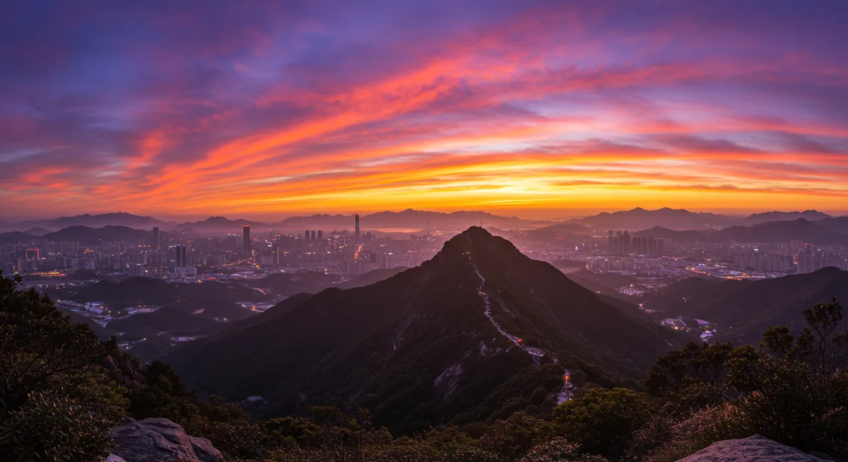
What to See Without Overloading the Route
The official Baiyun District profile names Moxing Ridge, Mountaintop Park, Nengren Temple, Yuntai Garden, Mingchun Valley and Luhu Lake among the wider area's attractions. They are not all quick stops on one linear trail, and some may have separate access arrangements.
Moxing Ridge
Moxing Ridge is the 382-meter high point and the clearest objective for hikers who want a summit. The payoff is weather-dependent, so keep the route flexible when clouds or haze reduce the panorama.
Mountaintop Park
Mountaintop Park is the upper cable-car terminus and the key route junction. It is the right place to reassess your time and energy before continuing toward Moxing Ridge.
Nengren Temple Corridor
Nengren Temple lies on the published southern internal route between the entrance and Mountaintop Park. Treat it as a possible cultural pause, but check current access on arrival rather than assuming every building or area is open.
Yuntai Garden, Mingchun Valley and Luhu Lake
These places belong to or adjoin the broader Baiyun Mountain experience, but adding all of them can turn a focused hike into an inefficient full-day circuit. Yuntai Garden fits most naturally near the southern start. Research current admission and connections separately before adding Mingchun Valley or Luhu Lake.
Half-Day and Full-Day Baiyun Mountain Plans
Efficient Half-Day Plan
- Arrive via Yuntai Garden Station and walk to the correct southern access point.
- Read the current cable-car notice and purchase the appropriate one-way or return fare.
- Ride to Mountaintop Park and take a short break before walking onward.
- Continue toward Moxing Ridge only as far as your turnaround time allows.
- Return by the confirmed cable-car service or walk down with a daylight buffer.
This format pairs well with a relaxed evening. A meal from our Guangzhou dim sum guide can precede a later start, while a Pearl River night cruise can follow if you leave enough transfer time.
Full Hiking Day
- Start at the south entrance in the morning after checking weather and service notices.
- Walk the developed southern corridor toward Nengren Temple and Mountaintop Park.
- Reassess conditions at Mountaintop Park before continuing to Moxing Ridge.
- Return to Mountaintop Park, then choose a walking or cable-car descent.
- Keep the evening light instead of adding another timed attraction.
A dedicated mountain day fits most comfortably into the 5-day Guangzhou itinerary. If you have fewer days, use the main Guangzhou itinerary planner to decide what the hike should replace rather than adding it to an already full sightseeing day.
Official Sources Used for This Guide
- Baiyun District government: Baiyun Mountain Scenic Area — updated November 26, 2025; used for area, hill count, Moxing Ridge elevation, address and named attractions.
- Guangzhou Development and Reform Commission cable-car rate order — issued May 16, 2025; used for full fares, reduced fares and the main-gate ticket rule.
- Baiyun Mountain scenic-area transport guide — released June 5, 2020; used for route relationships, published corridor distances and cable-car specifications. Its old fare table is not used for 2026 pricing.
- Guangzhou municipal government: Metro Line 11 opening — used to verify Yuntai Garden Station access.
Frequently Asked Questions
How difficult is the Baiyun Mountain hike?
Does the Baiyun Mountain cable car go to Moxing Ridge?
How much is the Baiyun Mountain cable car in 2026?
Do cable-car passengers need a separate Baiyun Mountain gate ticket?
How long should I spend at Baiyun Mountain?
Which metro station is best for the Baiyun Mountain cable car?
Can children or older travelers visit Baiyun Mountain?
Should I hike Baiyun Mountain in the rain?
Baiyun Mountain is easiest to enjoy when you make three decisions in advance: which entrance to use, whether the cable car is part of the plan, and where you will turn around. Build those choices into your wider Guangzhou itinerary, then leave enough flexibility for weather and operating changes.